

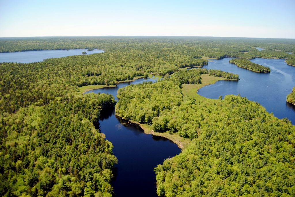
 Shelburne River Wilderness Area, in Queens County, protects nearly 3,500 hectares of remote wilderness within the lower reaches of the Shelburne River watershed.
Wedged between Tobeatic Wilderness Area and Kejimkujik National Park, this wilderness area helps protect ecological health and linkages in this region. The entire Shelburne River watershed is within these three protected areas.
Shelburne River was recognized in 1997 as a nationally significant river with its designation as a Canadian Heritage River under the federal-provincial Heritage Rivers Program. This was followed, in 1998, by the designation of Tobeatic Wilderness Area, which includes the upper reaches of the Shelburne River watershed. In 2009, the lower part of the watershed was designated as Shelburne River Wilderness Area and, in 2015, this was expanded to its current size. The Province acquired almost all of the lands in this wilderness area from the former Bowater Mersey Paper Company.
The remote and pivotal location between two large protected areas is especially important for wide ranging mammals, such as endangered pine marten and mainland moose, aquatic species such as native brook trout, and old forest-dependent species such as northern goshawk.
The area contains rare Atlantic coastal plain flora along the rocky lakeshores, and protects a Site of Ecological Significance at Pollards Falls, long recognized as one of the foremost old-growth eastern hemlock stands in this part of Nova Scotia. Many other stands of old red spruce, hemlock, and white pine forest occur throughout, especially near the river.
At its heart, Shelburne River Wilderness Area protects a wild and highly scenic river corridor. Part of a traditional Mi’kmaq travel route, this historic canoeing destination was made famous in the 1912 book “The Tent Dwellers,” by Albert Bigelow Paine. A chronicle of adventures in the Nova Scotia wilderness, the same route – which extends into the adjacent Tobeatic Wilderness Area – is followed today by those seeking a quintessential Nova Scotia wilderness experience. Adventurous travelers can also plan extended backcountry excursions from the Shelburne River system into the Jordan and Roseway systems in Tobeatic Wilderness Area. Visitors exploring the wilderness area may also find excellent opportunities for fishing, hiking, and camping.
Shelburne River Wilderness Area is most commonly access by canoe, after first crossing through either Tobeatic Wilderness Area or Kejimkujik National Park. A major forest access road that cuts through the lower part of the wilderness area and crosses the river, below Sand Lake, has traditionally been closed to public motorized use, in part to conserve the backcountry character and sensitive ecosystems of this part of Nova Scotia. This road is not part of the wilderness area.
Together, Shelburne River Wilderness Area, Tobeatic Wilderness Areas and Kejimkujik National Park form a major part of the protected core of the UNESCO Southwest Nova Biosphere Reserve . This international designation is reserved for globally important terrestrial, coastal or marine regions, where efforts are being made to reconcile the conservation of biodiversity with its sustainable use.